Planned treatments and updates available through an interactive map
JOHN
DAY, PENDLETON and BAKER CITY, Ore.
(May 15, 2023) – Fire management officials on the Malheur, Umatilla and
Wallowa-Whitman National Forests are preparing to implement spring prescribed
burning activities to reduce the risk of severe wildfire in the future.
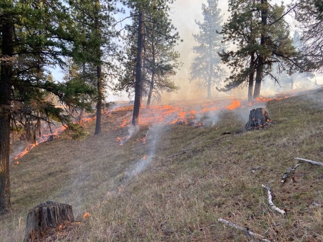
Frequent,
low-intensity fire is essential for healthy forests and reducing the risk of high
intensity wildfire caused by excessive fuel buildup. Prescribed burning is an effective tool for
removing excessive amounts of brush, shrubs, and trees, while also encouraging
the growth of native vegetation. In addition to reducing wildfire risk,
prescribed fire also improves overall forest health and resilience to insects
and diseases, and enhances habitat for elk, deer, and other wildlife. Forest
Service prescribed fire programs allows fire to play its natural role on the
landscape under controlled conditions.
Prescribed burning is also highly
dependent on weather conditions, which must be within a narrow criteria window
to use prescribed fire. Factors such as wind speed and direction, temperatures,
relative humidity, and fuel moistures are all taken into consideration prior to
implementing a prescribed burn operation.
Each prescribed burn represents many years
of planning and preparation to ensure burn operations meet prescriptive
conditions that allow for successful burns that provide multiple benefits to
resources. The forest works closely with the Oregon Department of Forestry and
Washington Department of Natural Resources in accordance with the State’s Smoke
Management Plans to determine when, where, and how much is burned on a daily
basis. Potential smoke impacts, looking
at volume of smoke, direction of spread, and mixing heights, are determined
prior to each burn. All burns will be
monitored until no heat is found within the unit and fire managers declare the
burn out.
Prescribed fire information for the Malheur, Umatilla, and Wallowa-Whitman National Forests is available to the public on a tri-forest online map. The map is labeled and color-coded to show each burn unit’s status: planned, active, or completed. Additionally, forest users can view other features including current and past-year burn units, National Forest boundaries and State wildlife management boundaries.
To learn more
about current and planned prescribed fires in the area, please visit:
- Online
prescribed fire map for the Malheur, Umatilla, and Wallowa-Whitman
National Forests
(example image below)
- Blue
Mountain Prescribed Fire Council Blog
- Blue
Mountain Interagency Dispatch Center
- John Day Interagency Dispatch Center and Burns
Interagency Communication Center
###
Comments
Post a Comment